


Filters
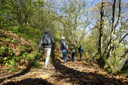
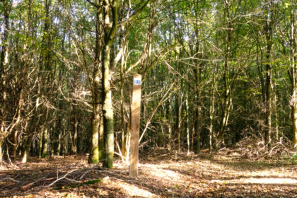
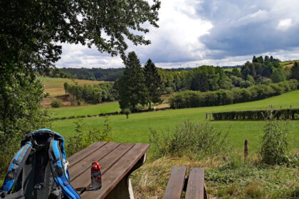
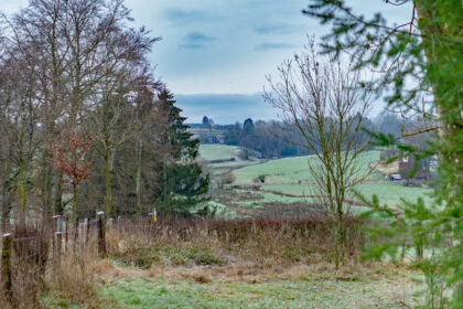
Walking
Enjoy the nature and the beautiful landscapes and lake of Bütgenbach. There are plenty of possibilities: short signposted walks, signposted long distance walks, walks for and with kids (fitness trails, geocaching and others), hiking nodes.
-
Overview hikes in Bütgenbach
An overview from all hikes in the commune of Bütgenbach, ranging from short to long.
-
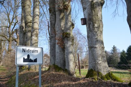
Across Nidrum
A beautiful hike year-round, and especially stunning during daffodil season!
4.5km Church Nidrum -

Totemus Bütgenbach
Bütgenbach 5.5km 58m TI Bütgenbach -

Trail through the hedgerows at Lake Bütgenbach
4.2km -

Kids’ walk in Bütgenbach
Water, climbing, and also a part of the cycle path.
Berg 2.3km 47m Grillhütte Bütgenbach, Warchestraße 59, 4750 Bütgenbach -
RED Trailrun Bütgenbach
Nice running route of 24 kilometers with some challenging trails. The route takes you to the places "Brückberg", "Knochenhöle", “Zosterbach” and "Herzebösch".
Berg 24km 538m Marktplatz Bütgenbach -

BLACK Trailrun Bütgenbach
Nice running route of 38 kilometers with some challenging trails in the commune of Bütgenbach.
Berg 38km 681m Marktplatz Bütgenbach -

BLUE Trailrun Bütgenbach
Course of 15 kilometers with some nice trails to Brückberg in Weywertz. On the program: idyllic views of the Warche river.
Bütgenbach 15km 361m Marktplatz Bütgenbach -

GREEN Trailrun Bütgenbach
11-kilometer trail run to the beautiful forest in Plättscheid. Start and finish in the heart of Bütgenbach.
Bütgenbach 11km 290m Marktplatz Bütgenbach -

VENNtrilogie
109-kilometer hiking pleasure, 6 regions, 3 areas: an unforgettable hiking adventure!
109km 1473m Marktplatz, Bütgenbach -
Around the lake
Around Lake Bütgenbach is a popular 10 km walk.
Bütgenbach 11.2km 23m Bütgenbach - Worriken 9 -

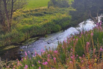
Daffodil hike
Mid april thousands of daffodils blossom in the Warche valley.
Weywertz 8.9km 55m Weywertz - church (HN 25><33) -

Daffodil hike with starting at the Tourist Info Bütgenbach
Mid april thousands of daffodils blossom in the Warche valley.
Bütgenbach 11.3km 98m Marktplatz Bütgenbach = Knotenpunkt 44 -
Historical discovery walk Bütgenbach Berg: 2,7/ 7,2 km
Berg Touristinfo, Marktplatz 13 a, 4750 Bütgenbach -
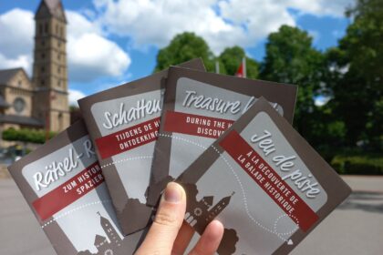
Treasure hunt
Follow the historical walk, look at the boards and find the solution.
Berg 7.4km Bütgenbach Marktplatz -

To Berger Venn
This hike goes to the Black Lake (Schwarzbachsee)
Elsenborn 7.3km 224m Parking, Am Breitenbach, 4750 Leykaul -

To the Bieley Rock (long hike)
Start your hike in Leykaul and discover the beautiful nature of the Bieley Rock
Elsenborn 16.3km 240m Parking, Am Breitenbach, 4750 Leykaul -

To Knochenhöhle
Hike to the woods and the pond where once was the cave of bones (Knochenhöhle)
Weywertz 11.1km 143m Nidrum - church- HN 28>< HN 23 -

Crossway of Weywertz
A nice, short, accessible 1,8 km walk in the middle of nature.
Weywertz 1.8km 30m Weinweg, 4750 Weywertz -

Hike along the Crossway Bütgenbach – Berg
This walk takes you along the 14 stations of the Crossway (start at the church in Bütgenbach and arrive at the chapel in Berg). You follow hiking nodes.
Berg 2km 65m Marktplatz, Bütgenbach - HN44 -
Panorama hike
The hike leads along the military domain, a very diverse biotope. On the program: wide views, lots of peace and beautiful nature.
Elsenborn 12.8km 130m Elsenborn - Kirche = Knotenpunkt 62 -

Memorial hike
94 km stage walk focusing on WW1 and WW2
Berg 96.6km 1396m -

To the Bieley Rock (short hike)
Wonderful 5,7 km hike to the Bieley rock with departure from the Gut Heistert (Kalterherberg-Germany)
Elsenborn 5.7km 109m Gut Heistert (Kalterherberg-Deutschland) -

Cross in the fens
Discover the huge cross in the fens that marks a pilgrim place
Leykaul - Küchelscheid 9.7km 155m Parking, Am Breitenbach, 4750 Leykaul -

Sunny Side
This hike takes you to the plateau at the lake of Bütgenbach. Apart from the climb to the village of Berg, it is a rather easy hike.
Berg 8.2km 72m Staumauer des Bütgenbacher Sees = Knotenpunkt 57 -

Mausheck (educational path)
Educational trail in a small forest with lots of oak trees. Near the valley of the warche. Beautiful especially in april when the daffodils bloom.
Bütgenbach 1.1km 22m Grillhütte, Warchestraße 59, 4750 Bütgenbach -

To Bütgenbacher Heck
A gem! First you discover the realm of the red kite. Then the hiking nodes lead you to the forests of Bütgenbacher Heck.
Bütgenbach 16km 246m Marktplatz Bütgenbach = Knotenpunkt 44 -

Warchetour
Hike from Bütgenbach to the centre of Robertville = no lap: 11 km
Bütgenbach 11km 160m Grillhütte Bütgenbach, Monschauer Straße, 4750 Bütgenbach -

On the heights around Bütgenbach
Long hike on the heights around Bütgenbach with beautiful views.
Berg 20km 256m Marktplatz Bütgenbach = Knotenpunkt 44 -

Fitness trail
Fitness trail - Vitality trail in the forests near Lake Bütgenbach
Bütgenbach 50m Worriken 9, 4750 Bütgenbach -

To Giesberg
A 12 km walk starting in Bütgenbach: to the dam, via Berg to Elsenborn and back via the dam and lake.
Bütgenbach 10.7km 159m Bütgenbach - Parking Marktplatz -
Warchetour Lap
Warche tour (=11 km) and back to the starting point = lap: 26,8 km
Berg 26.8km 341m Grillhütte Bütgenbach, Monschauer Straße, 4750 Bütgenbach -

To Burghügel
Beautiful 12 km walk in Weywertz: through forests and past idyllic spots.
Weywertz 12km 179m Weywertz - Kirche (zwischen KP 25 & 33) -

To Sankersborn
Nice, gentle hike to the place called Sankersborn: beautiful views and few altimetres. Follow the sign with a yellow cross.
Weywertz 7.7km 18m Weywertz - church ( HN 25 <> 33) -
To the old mill
Follow the hiking nodes through a beautiful landscape and its old mill at the Warche river.
Weywertz 7.6km 115m Weywertz - Kirche (zwischen KP 25 & 33) -

To Regenberg
13 km walk to the Regenberg Forest near Leykaul
Leykaul - Küchelscheid 12.4km 157m Elsenborn - Parking Thomabrücke -

Forest bath in Nidrumer Heck
Resource and slow down. Nidrumer Heck's forests are perfect for this.
Elsenborn 5.5km 81m Zosterbach Nidrum = Knotenpunkt 27 -

To the Warche Valley – short lap
Follow hiking nodes and discover the ideal warche valley during the 6.9 km long walk. In spring you'll be able to admire lots of daffodils.
Bütgenbach 6.9km 71m Market square Bütgenbach = hiking node 44 -

To the Warche Valley – long lap
This hike takes you along quiet, asphalted roads through the idyllic Warche valley to the village of Nidrum.
Bütgenbach 9.2km 152m Market square Bütgenbach = hiking node 44 -

Rurbusch
Hiking nodes will take you to nature reserves such as Herzogenvenn and Rurbusch and the ruins on the RAVeL.
Elsenborn 6.8km 155m HN 20 - Am Grünen Kloster -

Fungi walk
a 14 km hike, through the woods and our beautiful landscape with hedgerows and meadows! A very varied hike with, in Autumn, the most diverse fungi.
Nidrum 14km 178m Nidrum Kirche -

Christmas stroll in Elsenborn
From 06/12/25 - 09/01/26, in Elsenborn, a few places are decorated for Christmas, which can be visited during a lovely walk.
Elsenborn 7.6km 34m Elsenborn - Kirche -
Evening hike in Weywertz
Out of the december-hustle and rush into the nature.
Weywertz 10km 157m Weywertz - Kirche (zwischen KP 25 & 33) -

Winter hike 1 in Weywertz
Hiking trail away from the slopes as an alternative for non-skiers.
Weywertz 2.3km 26m Im Himmelchen 15, 4750 Weywertz - Bütgenbach -
Winter hike 2 in Weywertz
Hiking trail off the cross-country ski trails as an alternative for non-skiers.
Weywertz 4.3km 48m Im Himmelchen 15, 4750 Weywertz - Bütgenbach -

Kids on Tour – Fun in forest and water
Bütgenbach 6km 45m Bütgenbach, Parkplatz Muhrenberg -

Kids on Tour
-

Geocaching in Weywertz
During this walk you follow your GPS! Along the route, geocachers will find 7 traditional caches. The walk is 6 km long and you cover 70 altimeters.
Weywertz 5.1km 70m Im Himmelchen 15, 4750 Weywertz - Bütgenbach -

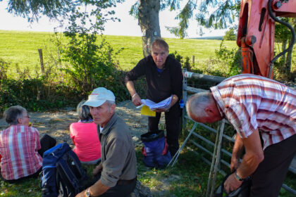
Auf Tour – Michael Scholl
-
Raymond Hanf
-

Outdoor Activity – Astrid Vliegen
-

Albert Desenfants
-
Natur ist der Weg – Shinrin yoku
-

Guides 4 You
-

Kids wagon
Go for a stroll with your toddlers or visit the biweekly market with our kids wagon
-

Hiking maps
-
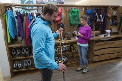
Testing of hiking equipment
-

Hiking route planner NodeMapp
-

GR-Routes: GR56
GR long-distance trails or Grande Randonnée 56
168km Eifel-Ardennen -

Long Bütgenbach hiking lap – Video
Join us on our virtual hike through the commune of Bütgenbach.
Berg 35km 272m Marktplatz Bütgenbach = Knotenpunkt 44