


Long Bütgenbach hiking lap – Video
Hiking nodes
44-42-45-49-51-48-53-54-11-12-6-9-56-69-59-58-65-62-67-68-27-30-21-25-22-35-32-29-23-18-34-39-44
Is it impossible or too difficult for you to discover the hiking node network? We do it for you and film each month a section of the extensive network. We have bundled the films in a playlist.
To know exactly where the route was filmed, you can surf to the Hiking Route Planner of East Belgium or look at the map that you can buy at the Bütgenbach Tourist Info Office. We wish you a lot of fun watching the films and of course we hope to meet you in real, because walking in real is also enjoying the smells, the sounds, the wind on your skin!

Long Bütgenbach hiking tour: overview
HN 21 - HN 25: 2,5 km
HN 30 - HN 21: 2,8 km
HN 27 - HN 30: 1,4 km
HN 68 - HN 27 : 2,3 km
HN 67 - HN 68 : 2,1 km
HN 65 - HN 67 : 1,2 km
HN 58 - HN 65: 2,5 km
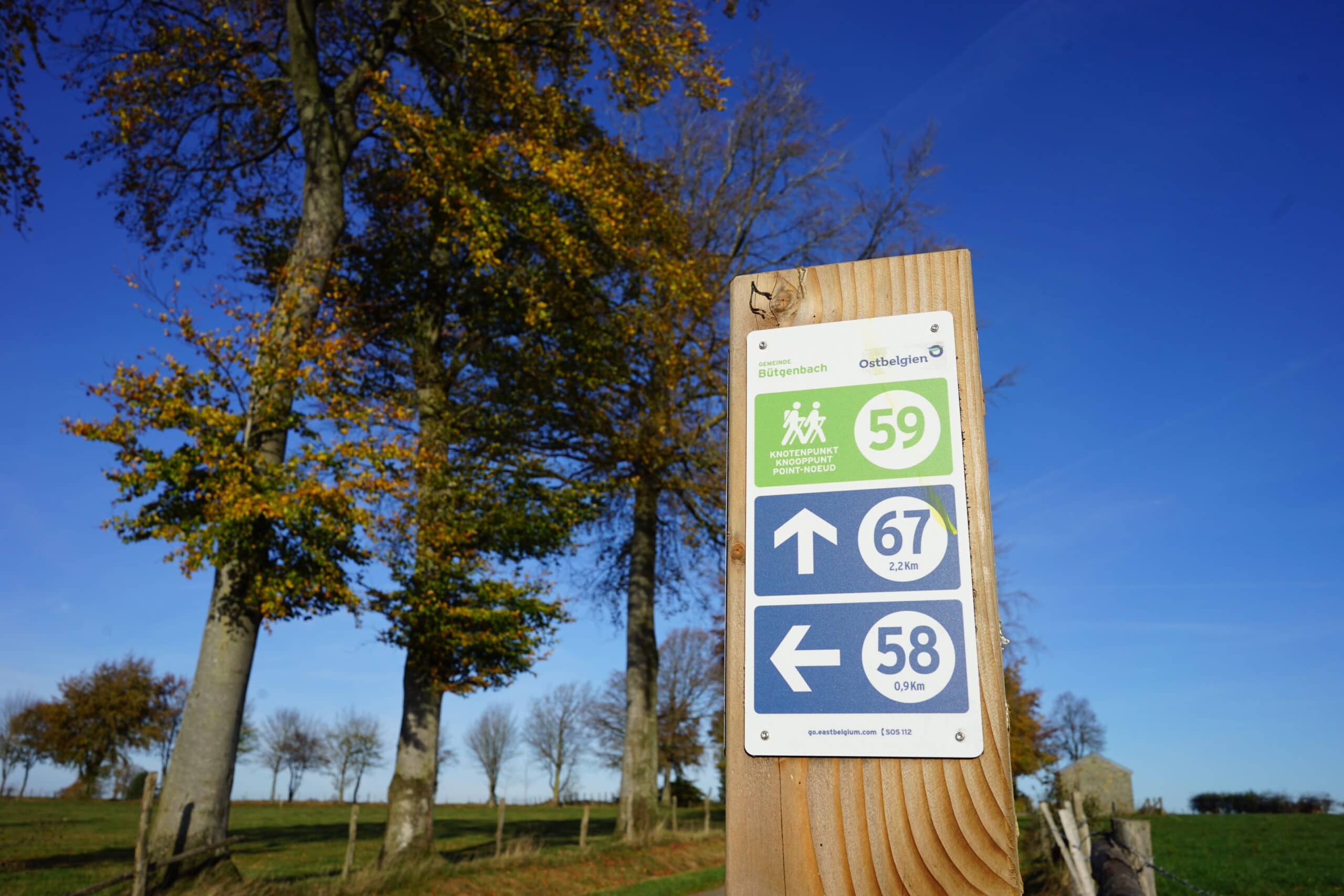
HN 59 - HN 58: 0,8 km
HN 69 - HN 59: 1,4 km
HN 56 - HN 69: 1 km
HN 6 - HN 9 - HN 56: 2,7 km
HN 11 - HN 12 - HN 6: 1,2 km
HN 48 - HN 53 - HN 54 - HN 11: 1,5 km
HN 45 - HN 49 - HN 51 - HN 48: 1,7 km
HN 39 - HN 44 - HN 42 - HN 45: 2,4 km
HN 23 - HN 18 - HN 34 - HN 39: 2,3 km
HN 35 - HN 32 -HN 29 - HN 23: 1,9 km
HN 25 - HN 22 - HN 35: 2,6 km
HN 21 - HN 25: 2,5 km
Tipp

You can import the route by scanning the QR code via the NodeMapp application.
Details
Code :
Start :
Marktplatz Bütgenbach = Knotenpunkt 44
End :
Marktplatz Bütgenbach = Knotenpunkt 44
Km :
35km
Vertical meters :
272m
Off-road :
60%