


Gravel North Bieley High Fens
This wonderful gravel ride is too short, don’t ride too fast 😊.
Take your time. Enjoy the beautiful and very diverse landscapes along the way, highlights such as the Bütgenbach dam and lake, the Bieley rock, the beautiful place of Herzogenhügel, the wonderful views of the Perlenbach lake, the daffodil meadows in spring, the High Fens, the Warche valley, not to forget the autumn colours and the gurgling water through beaver dams.
You cycle through meadows and forests, past bogs and lakes. On this loop you are part of a particular nature reserve. Listen for the sounds that are not coming from your bike. Cracking twigs. Movement in the bushes. Lonely as you may seem, you are never alone in these woods and fields. Sometimes the other inhabitants appear or make themselves known. These are moments to cherish.
Roadbook
Km 1-15
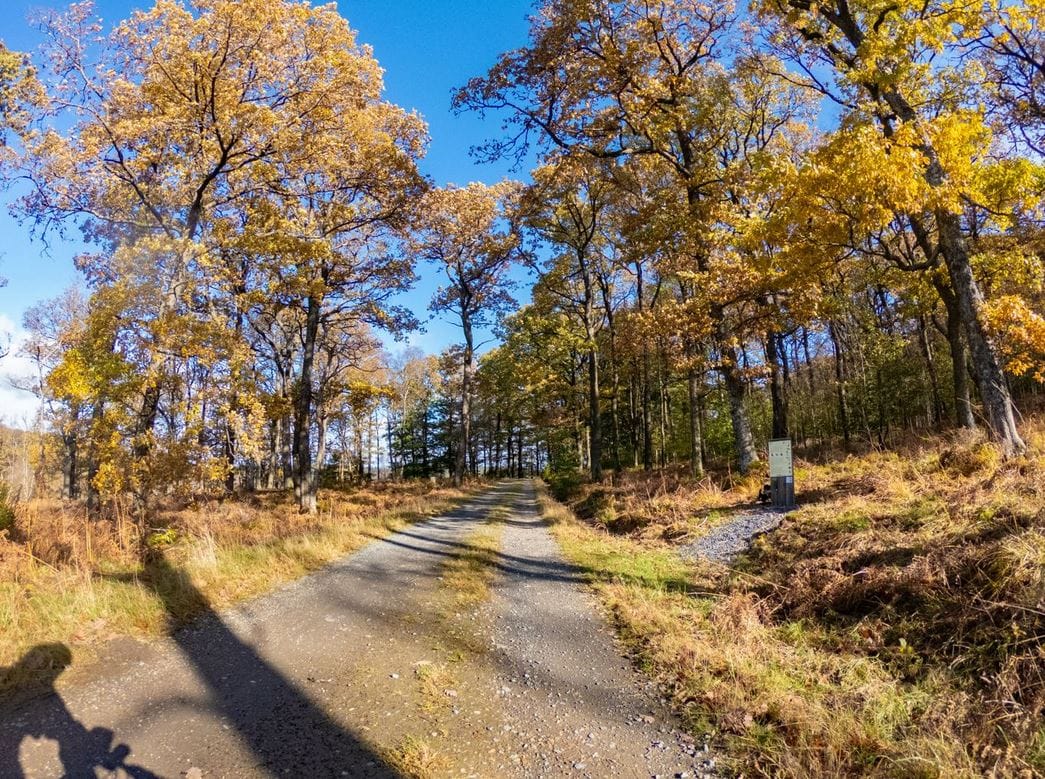
Your route starts with a passage over the remarkable Bütgenbach dam and continues on the path around the lake. There are also hikers here, so ride quietly and enjoy the beautiful lake to the full. After five kilometres, you climb to the heights of Elsenborn. It can be very windy at the top and the view is magnificent.
The memorial on the edge of the military domain commemorates the events of the Second World War at Elsenborn Ridge. The route now takes you into the Elsenborn woods which lie between the military domain and Wahlerscheid (Germany). This part of the route is a red zone and is sometimes closed due to shooting exercises. You can check when these shooting exercises take place on https://butgenbach.be/schiessuebungen-lager-elsenborn/.
Km 15-21
Broad forest roads lead you through woods and beautiful valleys. In the Krokesbach valley you pass a beautiful beaver biotope. If you leave the route at km 20.7 (in total count an extra 0.5 km to ride) and take a path to the left, you will come to a highlight of Elsenborn – Bütgenbach: the Bieley rock.
Km 21-50
The Perlenbach, a small stream, becomes your companion on the way to Monschau. The Perlenbach valley is known for its daffodils, a pleasure to pass through in spring. Kölschkier is a pleasant place to rest (with a compost toilet!). As tempting as it is to nestle on a bench in the sun, remember that you are only at kilometre 25.
The paths are still wide. The flow of the Perlenbach increases and flows into the dam of the same name. At the top you have a beautiful view of the lake. Take time to relax in the chairs (again)! Autumn gives this area warm, fire-like colours.
We are now approaching Monschau. The paths become narrower. Sometimes the coarse gravel shakes you up! You cross a bridge. Here you have to get off your bike (3 wide steps, experienced cyclists will stay on their bikes). You pass a camping site and now ride along the Perlenbach. The nature is beautiful. The path is narrow, but there are no technical difficulties. You cross the Perlenbach again, you have to get off the bike to carry it down six narrow steps. You now head for the main street in Dreistegen/Monschau. Be careful, cross the main street until you reach the bicycle path. After 200 metres you are already on the beautiful Ruruferradweg. Now you follow the river Rur for 3 km! You are approaching Küchelscheid.
After the Reichenstein Abbey, roots and rocks make the road a bit more difficult, but this old Eifel road is beautiful and offers fantastic views, views that you miss if you stay on the RAVeL (= alternative).
You pass through a German enclave (Ruitzhof) and slowly the High Fens come closer. First along the beautiful Schwarzbachsee, a first view of the fens with the Botrange tower in the distance, the beautiful Herzogenhügel, the old quarry and the beautiful rust-coloured Helle.
Km 51 - end
After crossing the Miesbach, the 3 km climb to the high plateau of the Fens begins. Enjoy the nature that surrounds you. The river Helle flows on your right.
And then: the splendid Walloon Fens. It is not easy to drive here. The soft peat makes a trampoline effect when there is a lot of water. On the left is a parallel road with a hard gravel surface, but then you miss the view over the fens.
The route now takes you to the highest point in Belgium – Botrange with its 694 m.
The last 20 km take you to Sourbrodt, Weywertz, Nidrum with their beautiful nature settings: Bosfagne with the “monument of the aviators”, Rurhof, Weywertzer Heck, the Warche valley.
Daffodils also bloom in the Warche valley in spring. The path along the Warche is very passable, with the exception of a 200-metre section: a few metres of descent, full of roots and stones, followed by a steep climb. Get off your bike, it would be a pity to miss the place by taking the road (=alternative).
One kilometre from the centre of Bütgenbach, you can enjoy the feeling of freedom one last time while enjoying the wide panorama.
Now you are back in the civilised world, where terraces and restaurants are welcome to exchange impressions of this beautiful adventure!
Tipp
- At the start of the route you will drive through a red zone that is sometimes closed due to shooting exercises. Before leaving, check this here https://butgenbach.be/schiessuebungen-lager-elsenborn/ .
- In addition, check the hunting calendar from late September onwards.
- Daffodils in spring
- This route is best ridden during dry periods in spring, summer or autumn. In winter, the roads can be heavy and muddy due to forestry works.
Details
Code :
GRAVNO
Start :
Tourist Info, Marktplatz 13 a, 4750 Bütgenbach
End :
Tourist Info, Marktplatz 13 a, 4750 Bütgenbach
Km :
75km
Vertical meters :
1100m
Off-road :
65%
Single trail :
5%